Hot weekend with storms returning soon
Sunday should see the temperatures cooling down

WICHITA, Kan. (KWCH) - Chief Meteorologist Ross Janssen says that our weekend gets off to a hot start, but as cold front moves closer, chances for storms will increase and temperatures will start coming back down. Severe weather is not likely this weekend, but a few strong storms may produce heavy downpours, small hail, and some gusty winds.
Saturday will have gusty winds throughout the day. Temperatures will start in the 70s and warm to near 100 for the afternoon. A heat advisory continues for much of central and eastern Kansas as the humidity remains very high. Scattered storm chances show up in western Kansas heading into the evening, but should weaken during the overnight hours.
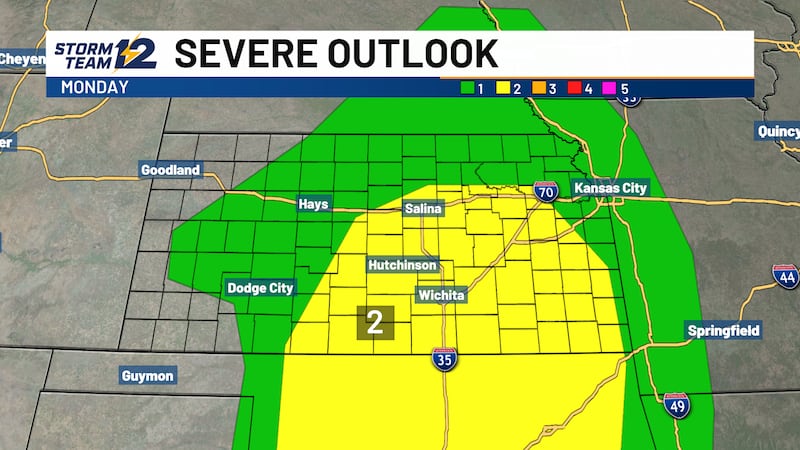
Sunday won’t be as hot. Highs will be in the low to mid 90s with chances for scattered evening storms. Some will produce pockets of heavy rain and gusty winds, but the severe chances are low. The front is expected to stick around into early next week, keeping temperatures near normal for mid-late July. There will be more rain chances coming our way for Monday and Tuesday.
WICHITA AREA FORECAST:
Tonight: Mostly clear; warm and breezy. Wind: S 15-25; gusty. Low: 77.
Tomorrow: Mostly sunny and windy. Wind: S 20-30; gusty. High: 100.
Tomorrow Night: Becoming mostly cloudy. Wind: S/SE 10-20. Low: 76.
Sun: High: 96 Becoming partly cloudy; scattered evening storms.
Mon: High: 93 Low: 74 Becoming partly cloudy; scattered PM/evening storms.
Tue: High: 91 Low: 72 Becoming partly cloudy; scattered storms.
Wed: High: 95 Low: 73 Mostly sunny.
Thu: High: 94 Low: 74 Becoming partly cloudy.
Fri: High: 95 Low: 74 Mostly sunny to partly cloudy.
Copyright 2020 KWCH. All rights reserved.