LIVE BLOG: 2 EF-1 tornados hit W. Kansas, follows day of extreme winds, blowing dust

WICHITA, Kan. (KWCH) - Saturday afternoon Update: The Goodland National Weather Service confirms that Friday night’s storms are now categorized as two EF-1 tornados.
One tornado struck Sharon Springs late Friday night, while the other hit east of Selden early Saturday morning.
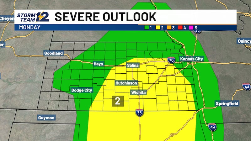
Late Friday night Update: The latest round of severe weather in Kansas wrapped up late Friday night with large-hail-and-potentially damaging-wind-producing storms impacting several counties in the west. As of Friday night transitions to Saturday morning, storm chances shift east, expected to weaken by the time they reach central Kansas. Initially, the next round of storms could pack a punch in western Kansas with more wind gusts of at least 60 mph. Storm chances linger in south-central Kansas into Saturday morning, but the winds are expected to weaken.
The storms followed issues with strong winds across Kansas throughout Friday. Winds kicked up dust that significantly reduced visibility out west, causing a temporary closure of I-70. A more significant break from recent wicked winds comes Sunday, and with that, some cooler weather is on the way, with highs dipping into the upper 60s to low 70s.
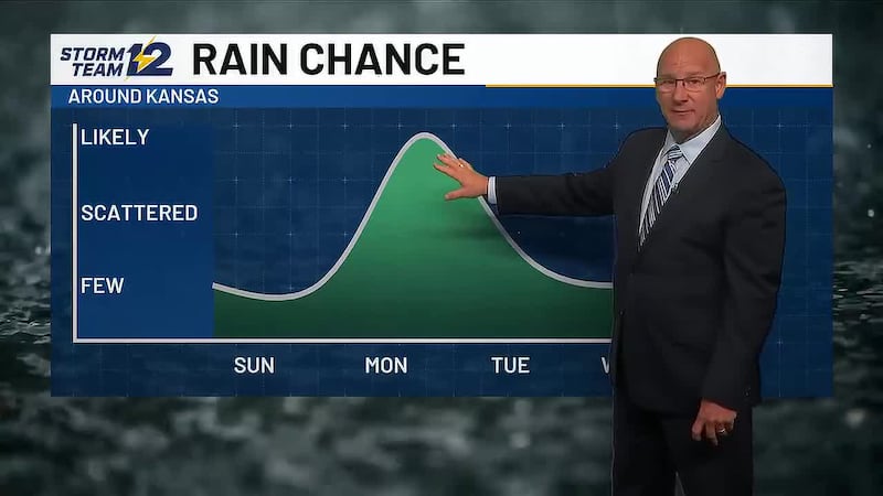
In the Wichita area, rain chances tail off Saturday, leading to a sunny stretch for a few days before the next chance for scattered storms next Thursday, April 26.
9:15 p.m. Update: Scattered storms across western Kansas through the evening could produce some hail and strong winds. A tornado is possible but on a minimal basis. Late in the night (after midnight), a line of storms may form and track east, with the main threat being wind gusts over 60 mph. Those storms will weaken in time before reaching central Kansas.
8:45 p.m. Update: The greatest concentration of storms is in Finney County in and around Garden City. One storm approaching Garden City packs a punch with winds of 70-plus mph. A storm south of town that could impact Garden City has the potential to dump large hail. Garden City police reported down power lines in the area, causing some power outages.
In northwest Kansas, storms that impacted several counties with strong winds and up-to-baseball-sized hail are moving northeast into Nebraska.
7:50 p.m. Update: Rotation was spotted with a large-hail-producing storm northeast of Ulysses in Grant County, but at this time, there is no tornado warning in effect. Storms firing up across western Kansas are moving northeast. In northwest Kansas, a storm near Colby had recorded wind speeds of more than 70 mph.
7:15 p.m. Update: As storms fire up in western Kansas, a tornado warning is issued for northeastern Wichita County and southeastern Logan County. A severe storm capable of producing a tornado was located near Leoti, moving northwest at 55 mph. This is a large-hail-producing storm with confirmation of baseball-sized hail in the town of Leoti in Wichita County.
5:47 p.m. Update, The Wichita County Sheriff’s Office confirms they are working a big fire on the Wichita/Scott county line. No homes are threatened at this time.
5:24 p.m. Update: Wind-fueled grass fires are forcing evacuations in Benkelman, Neb., according to emergency management for Cheyenne, Rawlins, and Sherman counties. Due to the uncontained wildfire, residents are being asked to immediately evacuate Main Street and east of town, north of the railroad.
K-283 is closed between U.S. 36 and the Nebraska state line due to high winds, low visibility, and fires.
High winds forced I-70 to close from Colby to Goodland earlier due to blowing dust and numerous crashes. The Sherman County Sheriff’s Office shared a photo of one of those crashes involving a semi.
Follow updates on road closures across Kansas at https://kandrive.org
4:47 p.m. Update: Eastbound and westbound lanes of I-70 between Goodland and Colby has reopened, according to the Kansas Department of Transportation. I-70 had been temporarily closed due to winds, zero-visibility conditions, and a vehicle crash.
4:42 p.m. Update: Northbound and southbound K-283 is being closed between U.S. 36 and the Nebraska state line due to high winds, low visibility, and fires, according to the Kansas Department of Transportation. The closing will remain until conditions improve.
The Kansas Department of Transportation (KDOT) has closed both east and westbound lanes of I-70 from Colby to Goodland due to blowing dust and high winds. The closing took place at 2:40 p.m. and will remain until conditions improve.
Due to high winds, zero-visibility conditions, and vehicle crashes, drivers in northwest Kansas are advised not to travel in the wind.
Trooper Tod Hileman shared a dashcam video from a trooper parked along I-70. In it, you see vehicles drive by and disappear into the dusty haze. Hileman said more semi-crashes are being reported in the area.
Check kandrive.org for updated road conditions.
Copyright 2022 KWCH. All rights reserved.